Lokoja at a Glance
Lokoja, the capital of Kogi state, was carved out of former Kwara and Benue States in 1991. The town and its suburbs also constitute the Kogi LGA. It lies on latitude 7o49’ N and longitude 6o44’ E at an altitude of 45-125 m, on the western bank of the Niger River, close to its confluence with the Benue River. It is some 160 km south of the new federal capital, Abuja, and straddles the strategic roads to at least five geopolitical zones out of the six such zones in the country. The terrain of the region comprises dissected undulating plains on the one hand, and lofty hill masses and mesas on the other. The plains have developed on the hummock of the Basement Complex, due to the removal of the overburdened Cretaceous sediments by erosion, while the hill masses and mesas have formed from the sedimentary formation, because of their resistant lateritic/ironstone capping. Lokoja, which lies on a plain element bordering the Niger River, is sandwiched between the Niger River and one of the main high plateau ridges, the mount Patti. The ridge, which is star-shaped, reaches an altitude of 400 m, and together with the Niger River, had streamlined the Lokoja town to a linear pattern.
The annual rainfall is about 1150 mm. Rains begin, on average, in March and peak in June to September, while the dry season begins at about November. Every month has an average temperature close to 300C. The weather is perpetually damp due to the high sensible temperature promoted by high humidity. The Niger and its main tributaries are characterized by flash floods superimposed on perennial flow. The Niger floods at Lokoja begin in July, peaks in October, and finishes by December. The smaller streams on the other hand are characterized by flash flow superimposed on rainy season flow, or simply flash flow only during and for a short time after run-off-producing storms. The groundwater resources so far located in the area occur in a perched form, and that explains the high failure rate of wells and boreholes located intuitively.
Historically, Lokoja was the first settlement of the British in Nigeria. It was the capital of the British Northern Protectorate and, by extension, remained a convenient administrative town for the British colonial government after the amalgamation of the northern and southern protectorates into one country called Nigeria in 1914. Lokoja served as a prominent centre for the slave trade in the 18th and 19th centuries. It later served as a centre for freedom when Samuel Ajayi Crowther spearheaded an anti-slavery crusade in Nigeria and erected the Iron of Liberty at a spot where slaves were set free in Lokoja. As the major inland port for European companies, Lokoja served as a commercial rendezvous for its agricultural region throughout most part of the 19th century.
Lokoja is a melting point of several ethnic groups and cultures. Its population numbered among others, the Bunu, Kakanda, Nupe, Gbagyi, Ebira, Yoruba, Hausa, Igbo, Bassa-Nge, and Igala. In addition, it has always counted among its population a pocket of immigrants from the Gold Coast (Ghana), Sierra Leone, and Europe. The famous confluence of rivers Niger and Benue, the beauty of the Patti Hill that is overlooking the town in the valley, the contrast between the brownish Niger waters and the bluish waters of Benue as they meet, are major points of attraction. Other notable points of attraction in the town include Lugard House, the first primary school in Northern Nigeria founded by Samuel Ajayi Crowther, the first Cantonment Church, the first hospital in Northern Nigeria, the Cenotaph (war armorial of fallen British and Nigerian officers in first and second world wars, Iron of Liberty, graveyards of deposed northern emirs banished to Lokoja, and Europeans’ cemeteries.
Since becoming the state capital, Lokoja has continued to experience rapid expansion, and today, it has absorbed several rural settlements on the other sides of Patti Hill. The town had a population of about 77,516 in 1991, which increased to 195,261 in 2006. The population has mainly been drawn to the town as a result of increased employment generated by many government departments and expansion of retail trade, iron ore/steel company, and cement factory at nearby Ajaokuta and Obajana, respectively, and higher educational institutions, including the Federal University Lokoja recently established.
Prepared by: Geography Department, Federal University Lokoja, February 2014
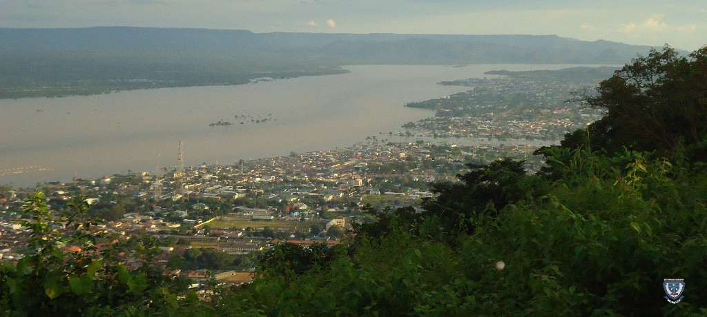
Lokoja Aerial View from Mount Patti
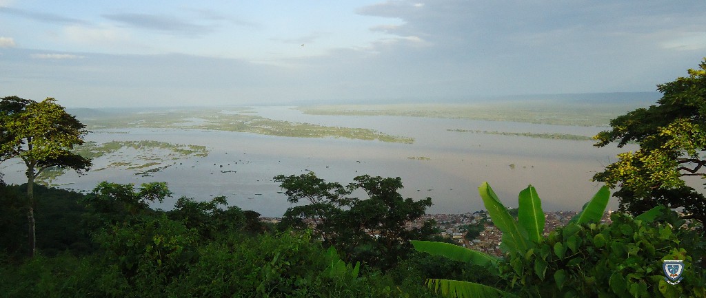
The confluence of rivers Niger and Benue from Mount Patti
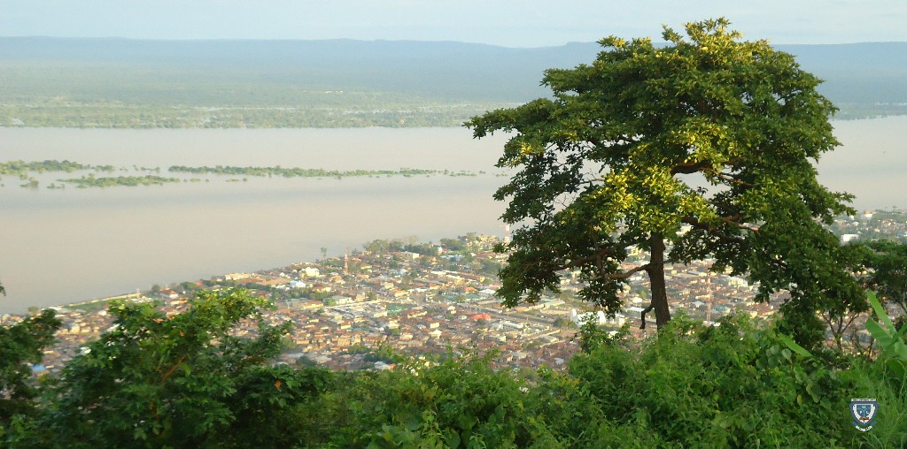
Lokoja Aerial View from Mount Patti
Latest News
-
Vice-Chancellor, Prof. Gbenga Ibileye, Elected Fellow of the Nigerian Academy of Letters
July 20, 2026, 9:14 pm -
BREAKING: NUC Grants Full Accreditation to FUL Nursing Programme
July 20, 2026, 8:46 pm -
PFN Honours FUL Vice Chancellor as Ibileye Calls for Knowledge, Skill, Grace in Pursuit of Greatness
July 19, 2026, 2:30 pm -
Verify Before You Act: FUL Unveils Hotlines to Curb Misinformation, Online Scam
July 18, 2026, 8:18 pm -
World PR Day 2026: Federal University Lokoja Celebrates The Golden Age Of Strategic Public Relations
July 15, 2026, 9:30 am -
Ibileye Reaffirms Commitment to Corps Members' Welfare, Career Growth at 2026 NYSC Employers' Workshop
July 14, 2026, 8:19 pm -
VC Courts Enduring Partnership with Media Icon Eugenia Abu, Envisions Centre of Excellence at FUL
July 13, 2026, 1:24 pm -
FUL Visits CUSTECH Osara, Explores Innovative Approaches to Campus Safety
July 11, 2026, 7:14 pm